GIS · Remote Sensing · Drone & DGPS Surveys · GeoAI · Environmental Studies contact@geohawkaerials.in+91 70284 78109
Request a proposal

Home / Our Work

Our work

Management plans, impact assessments, surveys and GIS studies completed for government, industry and NGOs across India.

MizoramTamil NaduMadhya PradeshMaharashtraChhattisgarhGujaratOdishaAndhra PradeshKarnatakaGoaKeralaTelanganaWest BengalDadra and Nagar Haveli and Daman and DiuPuducherryLakshadweepArunachal PradeshAssamNagalandMeghalayaManipurTripuraAndaman and Nicobar IslandsUttar PradeshRajasthanDelhiHaryanaSikkimBiharJharkhandLadakhJammu and KashmirHimachal PradeshPunjabUttarakhandChandigarhMaharashtraMadhya PradeshRajasthanWest BengalGoaTelanganaKarnatakaPunjab
What we have done

Projects completed pan India

From tiger reserves in Vidarbha to zoos in Goa and industrial sites in Madhya Pradesh, our teams have mapped, surveyed and assessed landscapes across the country.

MaharashtraMadhya PradeshGoaRajasthanTelanganaKarnatakaPunjabWest Bengal

Management plans

  • Chaprala, Pranhita, Kalsubai–Harishchandragad WLS
  • Painganga, Bhamragarh, Tipeshwar WLS
  • Maps for the Tadoba Management Plan

Impact assessments

  • For TATA, NTPC and Adani
  • Land impact analysis for NGOs in Maharashtra, Goa and Madhya Pradesh

DGPS surveys

  • Tadoba-Andhari Tiger Reserve
  • Bondla Zoo, Goa
  • Bhumi Abhilekh projects
  • Solar energy companies

Forest fire & GeoAI

  • Drone fire detection & suppression proof of concept
  • Burn-severity mapping
  • Conflict alert and land-change AI pilots
Pranhita Wildlife SanctuaryNawegaon National ParkNawegaon Wildlife SanctuaryBhamragarh Wildlife SanctuaryChaprala Wildlife SanctuaryKanhargaon Wildlife SanctuaryAndhari Wildlife SanctuaryTadoba National ParkGhodazari Wildlife SanctuaryNew Nagzira Wildlife SanctuaryKoka Wildlife SanctuaryUmred Kharandala Wildlife SanctuaryBor Wildlife SanctuaryNew Bor Wildlife SanctuaryExtended New Bor SanctuaryKaranja Sohal SanctuaryIsapur Wildlife SanctuaryPainganga Wildlife SanctuaryTipeshwar Wildlife SanctuaryNew GIB Wildlife SanctuaryYedshi Ramling Ghat WLSLonar Wildlife SanctuaryKatepurna Wildlife SanctuaryNarnala Wildlife SanctuaryWan Wildlife SanctuaryAmbabarwa Wildlife SanctuaryDnyanganga Wildlife SanctuaryJaikwadi Bird SanctuaryGoutala Autramghat Wildlife SanctuaryNandur Madhyameshwar Bird SanctuaryTansa Wildlife SanctuaryKalasubai Harishchandragad WLSBhimashankar Wildlife SanctuaryKarnala Wildlife SanctuaryThane Creek Flemingo SanctuaryTungareshwar Wildlife SanctuarySanjay Gandhi National ParkPhansad Wildlife SanctuaryTamhini Wildlife SanctuarySudhagad Wildlife SanctuaryMayureshwar Supe Wildlife SanctuaryBlackbuck Rehekuri and RGIB WLSNaigaon Mayur Wildlife SanctuaryGIB Wildlife SanctuaryYashwantrao Chavan Sagareshwar Wildlife SanctuaryRadhanagari Wildlife SanctuaryMalvan Marine WLSChandoli National ParkKoyana Wildlife SanctuaryAner Dam Wildlife SanctuaryYawal Wildlife SanctuaryGugamal National ParkMelghat Wildlife SanctuaryMansingdeo Wildlife SanctuaryPench National ParkNagzira Wildlife SanctuaryTadoba-Andhari Tiger ReserveChapralaPranhitaKalsubai–HarishchandragadPaingangaBhamragarhTipeshwarTadoba-AndhariGautala AutramghatSanjay Gandhi NPBorRadhanagari
Wildlife management plans

Protected areas we have planned and mapped

Decadal Wildlife Management Plans and complete map sets prepared for the Maharashtra Forest Department, following MoEFCC guidelines and committee recommendations.

  • Chaprala Wildlife SanctuaryGadchiroli
  • Pranhita Wildlife SanctuarySironcha, Gadchiroli
  • Kalsubai–Harishchandragad Wildlife SanctuaryNashik Wildlife Division
  • Painganga Wildlife SanctuaryPandharkawada, Yavatmal
  • Bhamragarh Wildlife SanctuaryAllapalli, Gadchiroli
  • Tipeshwar Wildlife SanctuaryPandharkawada, Yavatmal
  • Tadoba-Andhari Tiger ReserveMaps for the Management Plan, Chandrapur
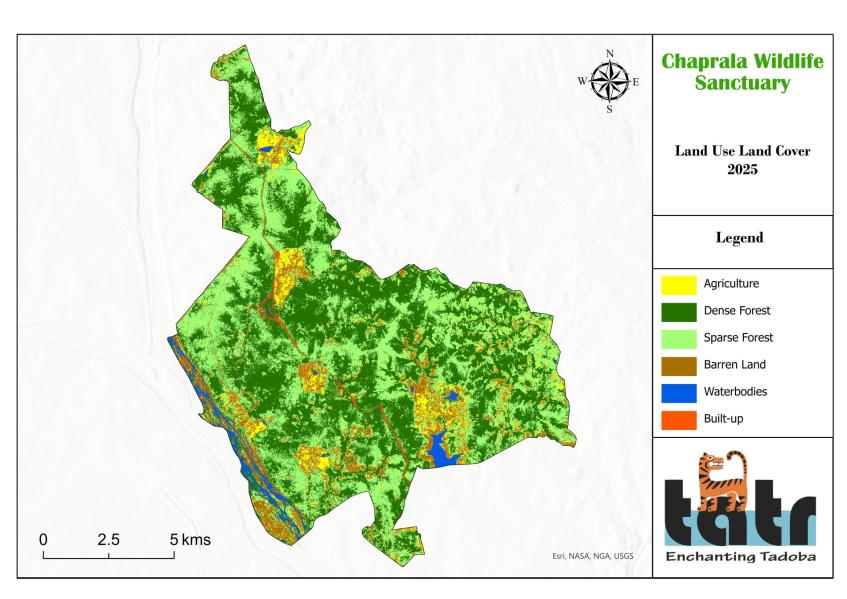
LULC map, Chaprala WLS
Land use / land cover · Chaprala
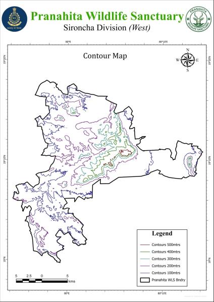
Contour map, Pranhita WLS
Contours · Pranhita
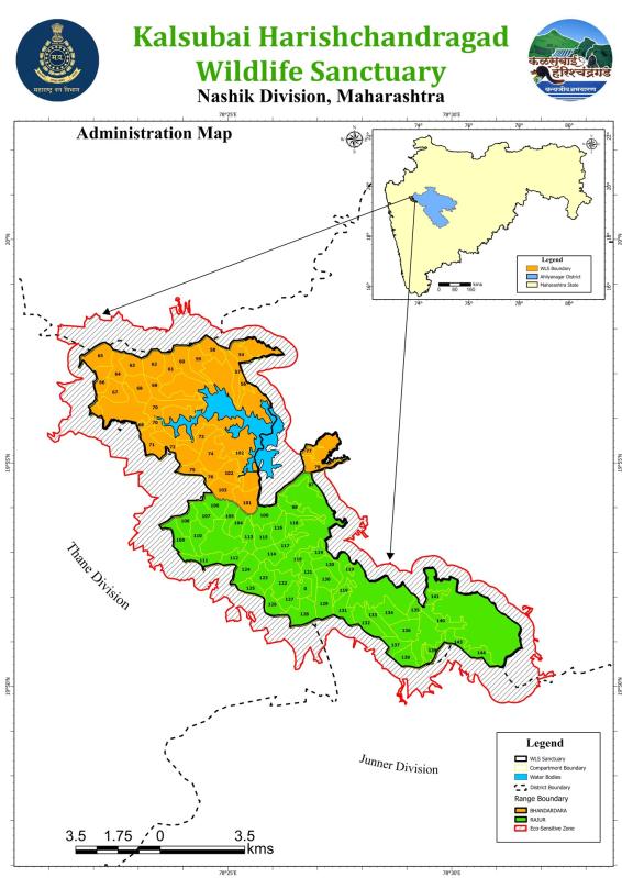
Administration map, Kalsubai–Harishchandragad WLS
Administration & ESZ · Kalsubai
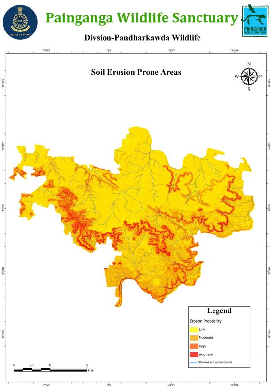
Soil erosion map, Painganga WLS
Soil erosion · Painganga
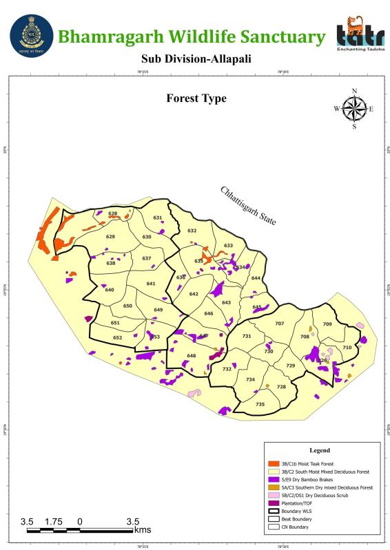
Forest type map, Bhamragarh WLS
Forest type · Bhamragarh
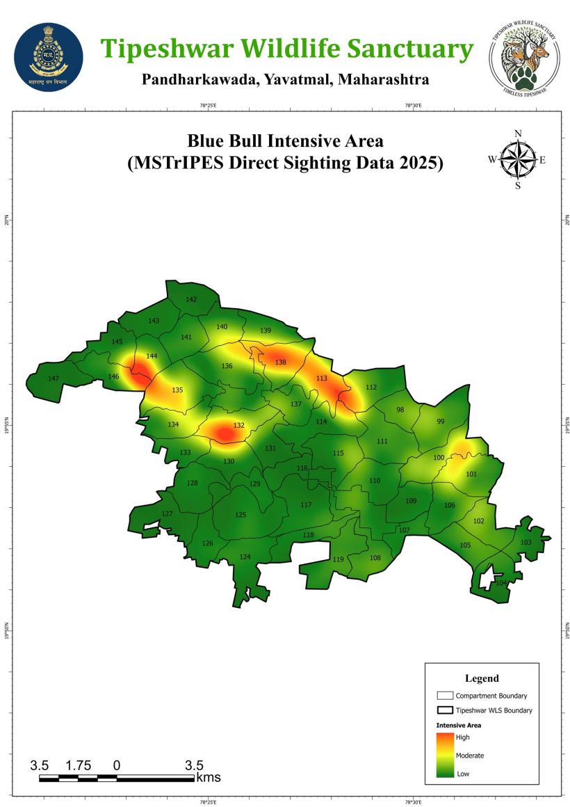
Species intensive area map, Tipeshwar WLS
Species density · Tipeshwar
Featured landscape

Tadoba-Andhari Tiger Reserve, Maharashtra

Maharashtra's oldest and largest tiger reserve, where GeoHawk has prepared maps for the Management Plan and carried out DGPS surveys for the reserve.

79.0°E79.2°E79.4°E79.6°E79.8°E19.9°N20.1°N20.3°N20.5°N20.7°NTadobaNational ParkAndhariWildlife SanctuaryBuffer zoneGhodazari WLSKanhargaon WLSChandrapurCHANDRAPUR DISTRICT01020 kmN

Our work in Tadoba

  • Thematic maps for the Tiger Reserve Management Plan
  • DGPS surveys for the reserve
  • Plot-wise land-use layout plan for a rehabilitated village in the buffer, for the Office of the Deputy Director (Buffer)
Tadoba National Park (core) Andhari Wildlife Sanctuary (core) Tiger reserve boundary incl. buffer Neighbouring sanctuaries

Map prepared by GeoHawk Aerials from open government data: tiger reserve and protected-area boundaries from MoEFCC Parivesh and PM GatiShakti, district boundaries from Census of India, via the india-geodata project (CC BY 4.0).

Discuss a protected-area project
Zoo planning · DGPS survey

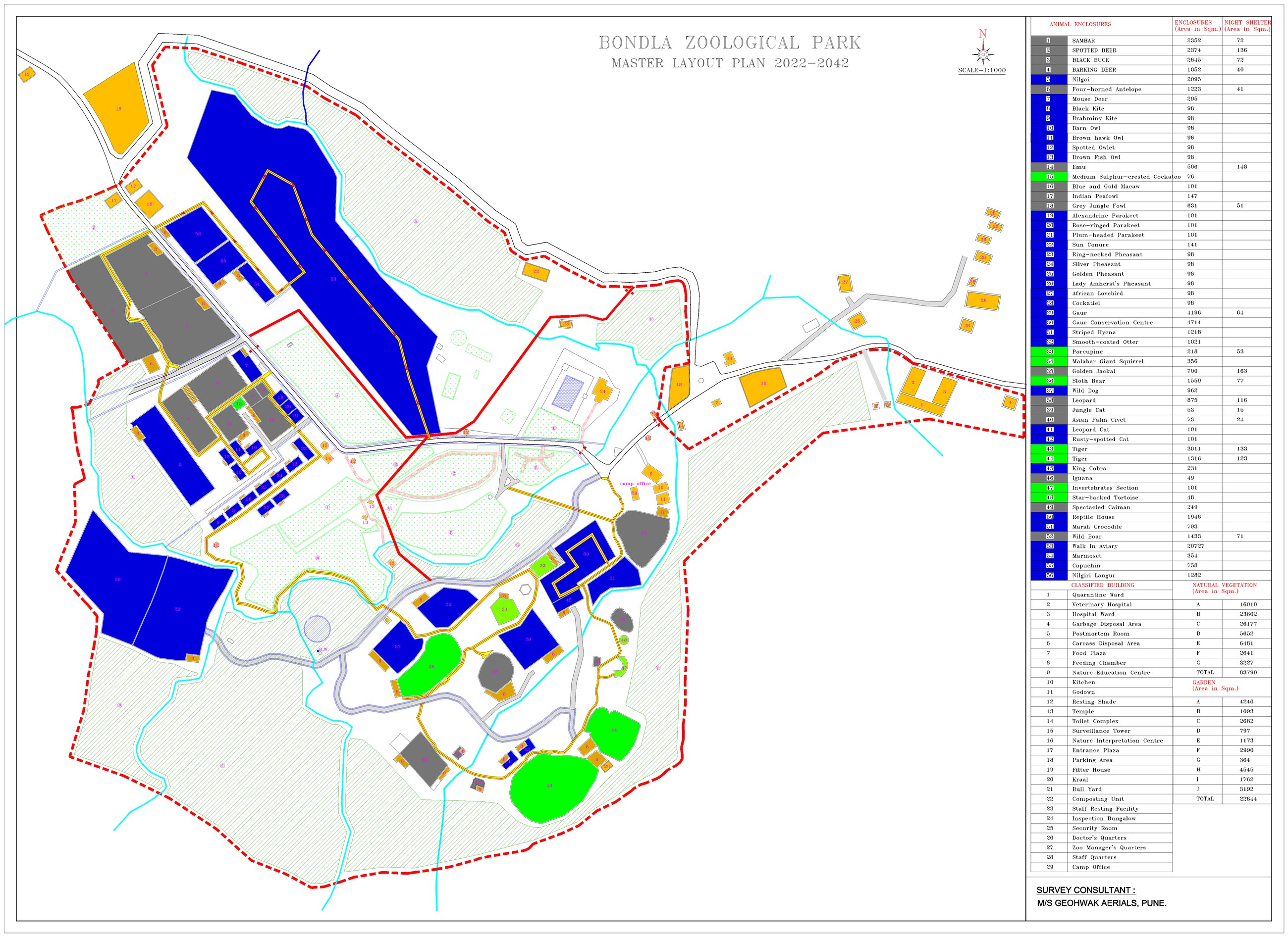
Bondla Zoological Park, Goa

Master Layout Plan 2022–2042, prepared by GeoHawk Aerials as survey consultant.

Bondla Zoological Park master layout plan 2022–2042 at scale 1:1000

What we delivered

  • Survey-grade DGPS mapping of the entire zoo
  • Master layout plan at 1:1000 scale
  • Every animal enclosure and night shelter with areas
  • Hospital, quarantine, education centre and staff buildings
  • Roads, visitor paths, streams and zoo boundary
  • Natural vegetation and garden zones with area statements
Open full-size layout Plan a similar survey
Featured projects

Selected case studies

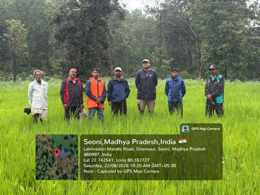
GeoHawk survey team in the field, Seoni, Madhya Pradesh
Wildlife Conservation Plan · NTPC

Wildlife Conservation Plan for a thermal power expansion

Jhabua Power Ltd (JV of NTPC), Seoni, Madhya Pradesh

Challenge
Environmental clearance for a plant expansion required a scientific wildlife conservation plan for the surrounding landscape.
What we did
Grid-based field surveys of plants, birds, mammals and roadkills, village interviews, and satellite habitat mapping, followed by baseline, impact assessment and conservation plan reports.
Outcome
Recorded the Critically Endangered Indian Vulture near the plant and set vulture conservation as the plan's top priority.
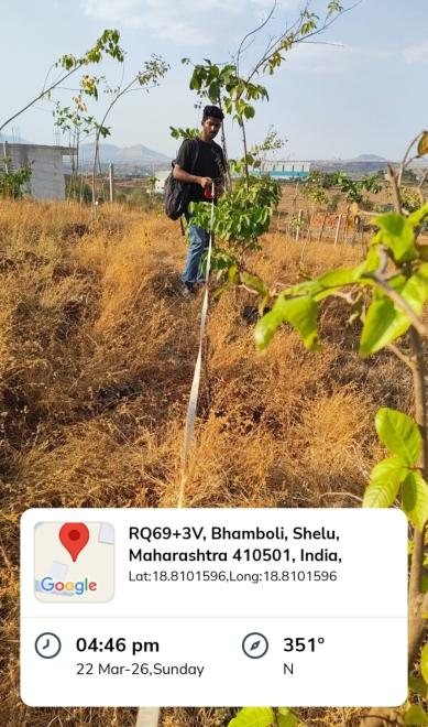
Geo-tagged field survey record
Biodiversity Assessment · Renewable energy

Biodiversity assessment for a hybrid solar and wind project

Chhatrapati Sambhajinagar district, Maharashtra

Challenge
The developer needed a reliable bird and wildlife baseline and a view of turbine and power-line risks.
What we did
Standard bird point counts and transects, habitat mapping from satellite imagery, and a wingspan-based collision-risk method.
Outcome
Documented eagles nesting on a transmission pylon and power-line mortality, with clear mitigation measures, raw data, scripts and KMZ files.
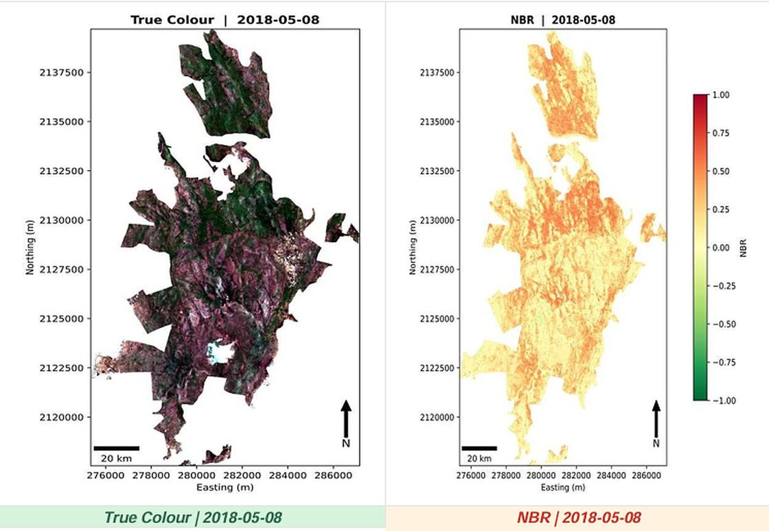
Burn-severity analysis, Sanjay Gandhi National Park
Forest Fire · Proof of concept

Forest fire mitigation: from satellite to drone

Forest Department, Maharashtra · with technical partners

Challenge
Forest fires spread before teams can locate and reach them.
What we did
Fire-prone area maps and burn-severity analysis from satellite data, and a drone system that detects smoke and flame with AI and drops dry-chemical extinguishers.
Outcome
A working proof of concept demonstrated for the Forest Department, with a GIS dashboard for fire events.
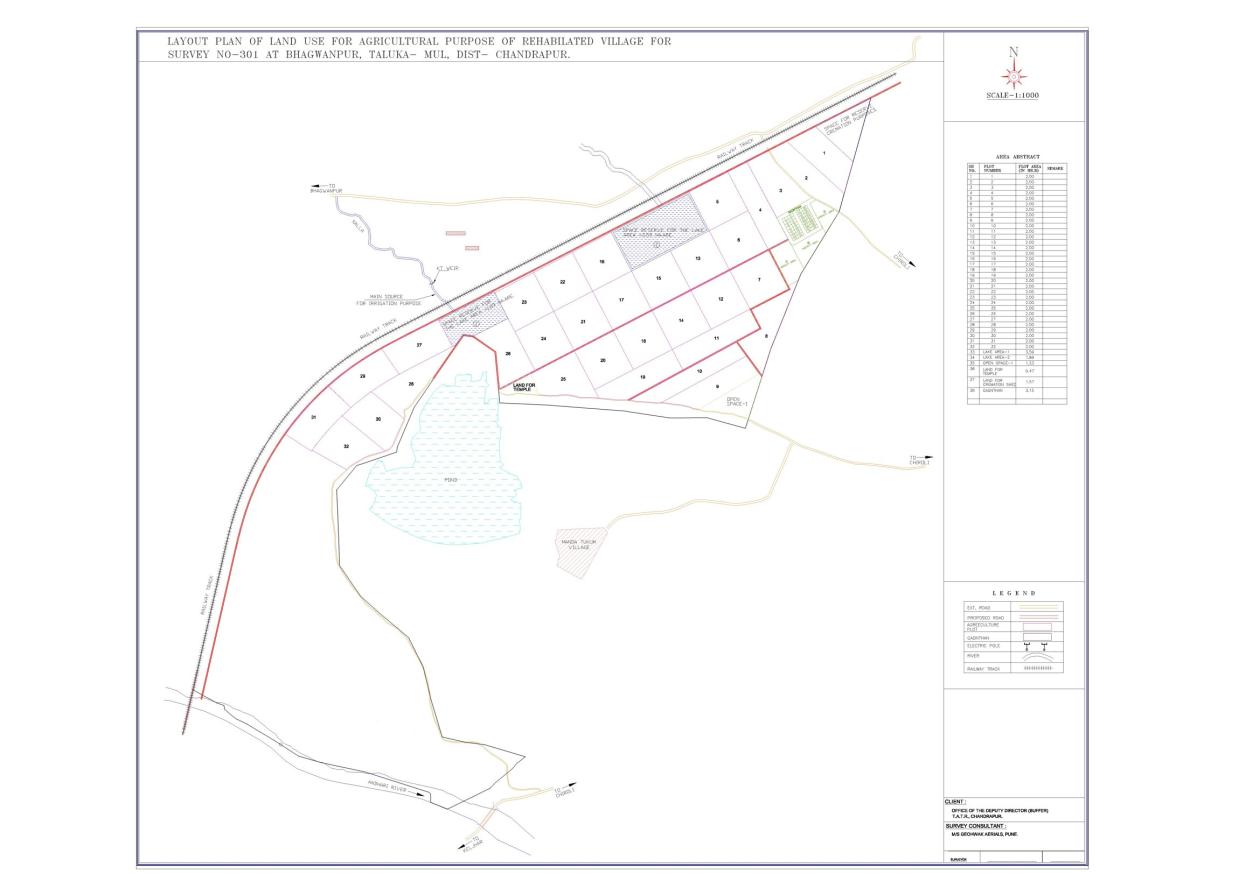
DGPS land-use layout plan, Bhagwanpur, Tadoba buffer
DGPS Survey · Tiger reserve

Land-use layout for a rehabilitated village

Tadoba-Andhari Tiger Reserve (Buffer), Chandrapur

Challenge
A village relocated from the tiger reserve needed accurately surveyed plots and civic spaces.
What we did
High-precision DGPS survey and a 1:1000 plot-wise layout with roads, irrigation source, water bodies and civic areas.
Outcome
A layout plan and area abstract ready for administrative use by the reserve's buffer office.
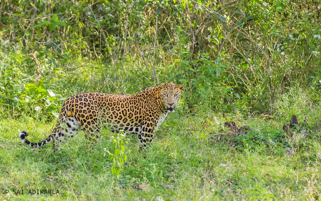
Indian leopard in grassland
GeoAI · Human–wildlife conflict

Human–leopard conflict mapping and alert system

Junnar Forest Division · with Fergusson College and Garware College

Challenge
Leopard conflict incidents needed to be predicted and responded to faster.
What we did
Hotspot mapping from rescue and incident records and an automated alert demonstration.
Outcome
A decision-support system presented to the District Planning Officer, Pune.
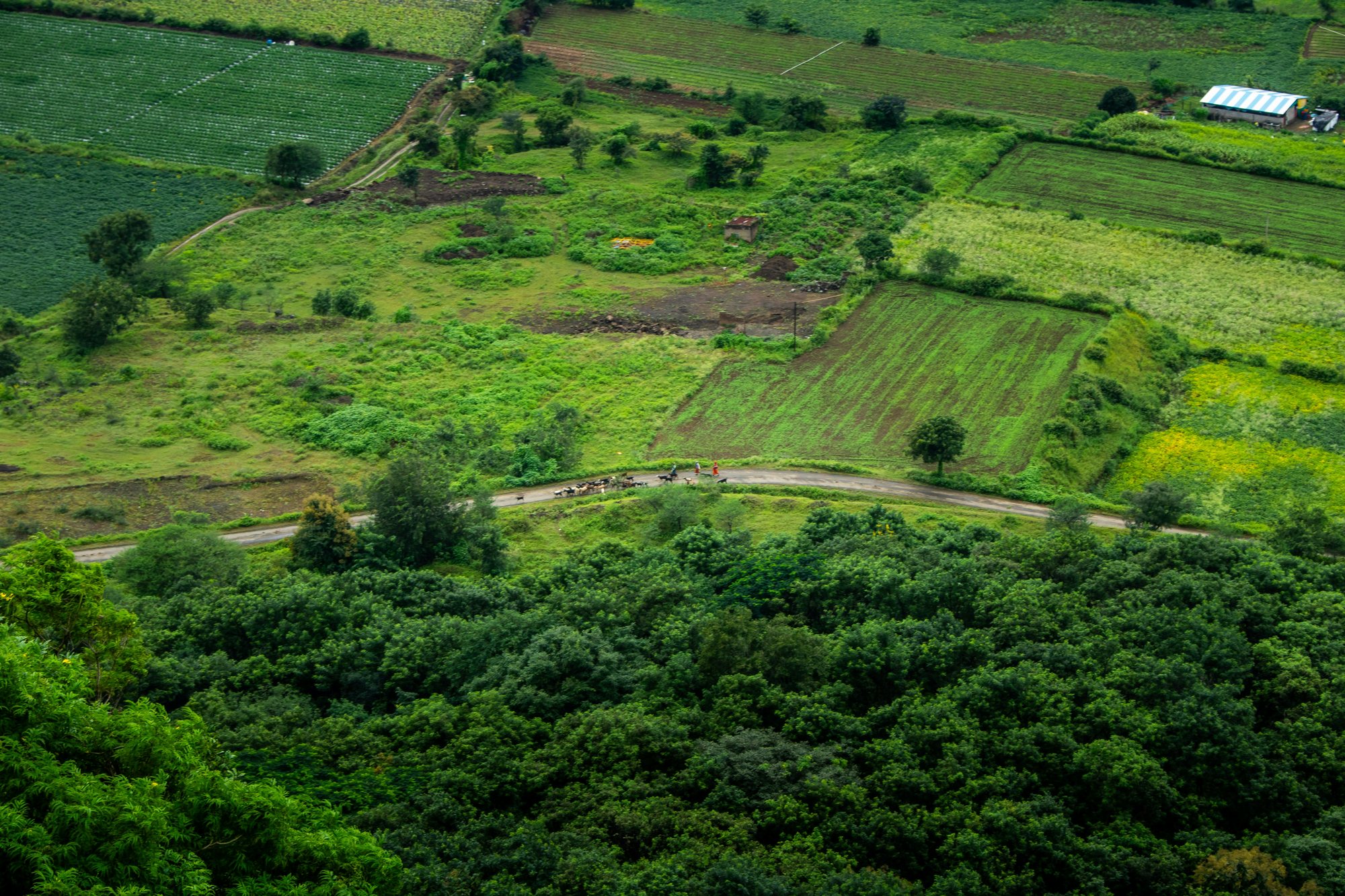
Aerial view of farmland and forest near Junnar, Maharashtra
Impact Analysis · NGOs & CSR

Land impact analysis for NGOs and CSR programmes

Maharashtra, Goa and Madhya Pradesh

Challenge
NGOs and CSR teams needed proof that their land and plantation work was making a difference.
What we did
Before-and-after satellite analysis of vegetation, water bodies and land use, verified in the field.
Outcome
Clear, map-based evidence of impact for donors, partners and reports.

Photo: Zoshua Colah on Unsplash (Unsplash License)

Have a project in mind?

Tell us your site and requirement. We will reply with an approach and a quotation.

Photo credits
  • Collapsed bridge @ Periyavara, Munnar #kerala #flood 2018 by Mathew S Thomas, CC0 (public domain) · source
  • Lifting off by OregonDOT, CC BY 2.0 · source
  • Tiger in the wild Rathambore by amanderson2, CC BY 2.0 · source
  • Landslides in Himachal Pradesh by Sridhar Rao, CC BY-SA 4.0 · source
  • Topography equipment by unknown, CC0 (public domain) · source
  • Surveyor Using GNSS Receiver with RTK Solution by SweetCanadianMullet, CC BY 4.0 · source
  • Indian Leopard by Sai Adikarla, CC BY 2.0 · source
  • How Warm Was This Summer? by NASA Goddard Photo and Video, CC BY 2.0 · source
  • Flooding in Pakistan Sept 7th, 2010 by NASA Goddard Photo and Video, CC BY 2.0 · source
  • Landsat View: Dubai, United Arab Emirates by NASA Goddard Photo and Video, CC BY 2.0 · source
  • Landsat View: Western Suburbs of Chicago, Illinois by NASA Goddard Photo and Video, CC BY 2.0 · source
  • NDVI of irrigated fields by Tomchenko Olha, CC BY 4.0 · source
  • Adapted from "Universal Atlas of the World, A cartographic map of the British Isles." by Free Public Domain Illustrations by rawpixel, CC BY 2.0 · source

Openly licensed photos sourced via Openverse (Flickr, Wikimedia Commons, rawpixel). All maps and field photographs are GeoHawk Aerials' own work.